Portland Evictions Equity Analysis
Created in 2021 as pro bono work
Download a pdf of the map series
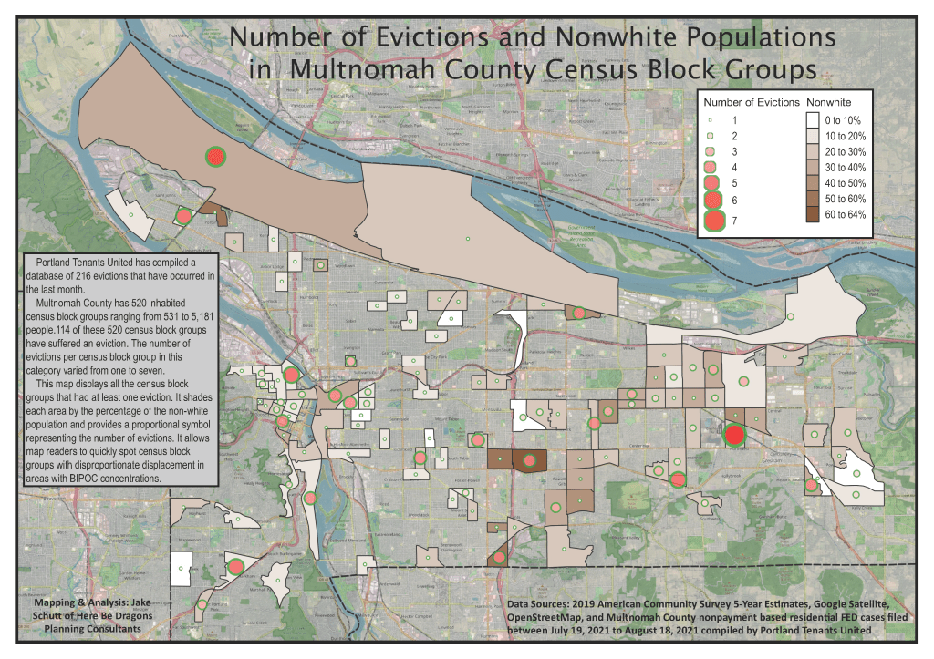
I provided pro bono spatial analysis and cartographic support to Portland Tenants United. This was at the request of a local housing advocate friend of mine. The goal was to understand the locations of nonpayment evictions in Multnomah County. This was during the late stages of the COVID pandemic. We also aimed to find out how those patterns intersected with race. Using a dataset of 216 recent residential evictions compiled by the organization, I geocoded the locations of individual evictions. I created a countywide heat map to highlight displacement hotspots. I also joined cases to 520 inhabited census block groups to calculate per capita eviction rates.
I merged eviction counts with American Community Survey estimates of nonwhite populations. This effort was to build an equity-focused map series. The series visualized both the intensity of filings and their concentration in BIPOC communities. The final products helped tenant organizers communicate where displacement pressures were most severe. This was especially true in downtown Portland, the inner east side, and parts of the Rockwood area. The products also provided evidence to support targeted anti-eviction outreach and policy advocacy.
