Environmental Justice analysis of Minnesota’s Aviation system
Created in 2019 for the Minnesota Department of Transportation’s Office of Aeronautics
Download report excerpt: Environmental Justice Research and Methodology
Download report excerpt: Spatial Analysis and Findings
Download report excerpt: Selected Airport Maps and Demographic Profiles
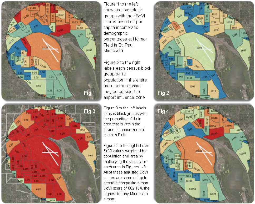
Early in my first full-time planning position with the Minnesota Department of Transportation (MnDOT), I conceived and received approval to undertake an original environmental justice study examining the social vulnerability of communities surrounding Minnesota’s airports. The project grew out of my interest in applying GIS and demographic analysis to better understand how transportation infrastructure and land use decisions intersect with historically marginalized communities.
I began with extensive research into environmental justice policies and the analytical methods federal and state agencies use. Building on this research, I developed an original methodology using 14 demographic indicators from the American Community Survey to create a composite Social Vulnerability Index (SoVI). Using statistical classification, GIS analysis, and population-weighted scoring, I evaluated social vulnerability across 134 airport influence zones throughout Minnesota by applying these methods to 4,107 census block groups.
The analysis revealed significant differences in the geographic distribution of socially vulnerable populations, particularly among communities within airport influence zones. These findings provided evidence to inform more equitable public engagement and aviation planning strategies. Importantly, the consulting team preparing the 2022 Minnesota State Aviation System Plan adopted and replicated my methodology with updated demographic data.

