MnDOT Cartography and GIS Portfolio
Created from 2018 to 2021 for the Minnesota Department of Transportation
Download my MnDOT cartography portfolio
This PDF is a curated set of cartographic work I completed at the Minnesota Department of Transportation. I worked there from 2018 through 2023. During this time, I advanced from an intern into three consecutive contract positions. Most of these projects were done for the statewide Office of Transit and Active Transportation. I also completed additional work for the Aeronautics Office. At that time, my role was heavily focused on GIS analysis and the creation of illustrative maps. This was before I took on principal planner responsibilities at MnDOT’s Metro Office.
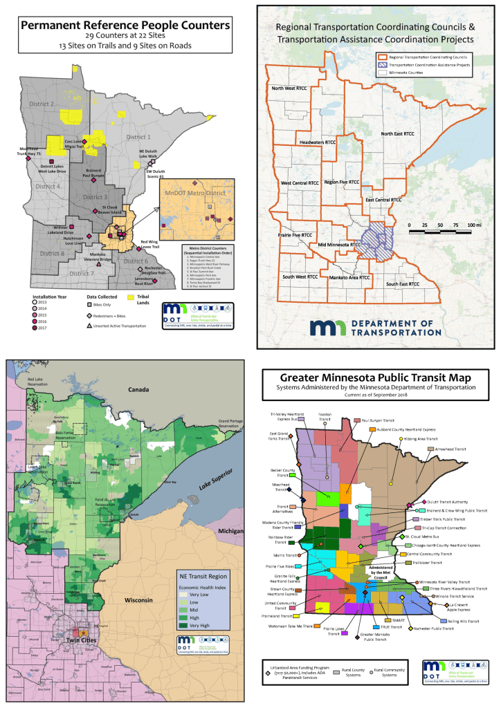
The maps illustrate a range of topics and scales that supported real planning and policy decisions. Examples include statewide views of Greater Minnesota public transit systems, permanent active transportation counters, and regional transportation coordinating councils. There is also detailed equity mapping, including vulnerability mapping, like economic health indices and social vulnerability indices, in the northeast transit region. Additionally, racial subcategory populations in Greater Minnesota were examined for a Title VI report to the Federal Transit Administration. Furthermore, a composite social vulnerability analysis is conducted around Minneapolis–St Paul International Airport. These products combined statewide and local datasets. They used careful symbology and labeling with clear legends. This was so that staff, partners, and elected officials could quickly understand coverage gaps. They analyzed coordination structures and identified who is most affected by transportation investments or lack of service.
After 2022, as a principal planner, my final years at MnDOT shifted toward development reviews and project management for corridor studies. Nevertheless, this earlier body of work reflects my long-standing commitment to GIS and cartography. I have more than twenty-five years of experience. I am fully capable of designing and executing spatial analyses to produce professional-quality maps that accurately and efficiently communicate results to both technical and non-technical audiences.
